The Piedmont Heights Civic Association


Piedmont Heights is Atlanta’s oldest community, settled in 1822 by Benjamin Plaster. This was two years before Archibald Holland bought a tract where Terminus, now Atlanta, was founded in 1837. Plaster built a bridge over Peachtree Creek and the trail to it later became Piedmont Road.
In 1835 a one-room log schoolhouse was built beside a “cool, clear sparkling spring” bubbling from under a rock at the intersection of today’s Piedmont and Rock Springs roads, and the area became known as the Rock Spring Community. Gradually a little township called Easton grew up on Clear Creek where Ansley Mall is located today.
In 1864 General Sherman swept through Georgia and his troops, camped on the edge of Easton, did considerable damage to the area. After the war, the little schoolhouse was rebuilt and soon shared with the Union Sunday School. Civil War veteran Captain James M. Liddell bought 40 acres near the school and built his home, which some say is Atanta’s second oldest, at 464 Montgomery Ferry Road.
Rock Spring Presbyterian Church was founded in 1870 “on a level and beautiful spot with a noble forest growth around it, a neat-looking attractive church, flanked by a cozy little schoolhouse.” Charter member Hezekiah Cheshire’s descendants remain active members of the church, now down to the seventh generation.
In the 1870s the Air Line Belle train, “finest on the line,” began service from Toccoa to Atlanta, with a stop in Easton. A depot and a post office attracted 100 residents to Easton by 1888 and in 1895 a new highway to Atlanta called North Boulevard passed through the town and spurred additional growth.
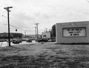
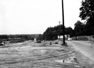
The post office closed in 1904 and train service ended in 1918. The area was still considered country but Atlanta began annexing it, renamed it Piedmont Heights, and soon new homes appeared. In 1925 Landscape Architect W. L. Monroe bought 13 acres on North Boulevard. He built a nursery called Monroe Gardens which was popular as a gathering place for Atlantans. In 1937 the boulevard was renamed Monroe Drive. Of the many buildings Monroe built only two remain; now resembling English garden follies on the grounds of a condominium complex. In the late 1940s Interstate Highway 85 was built along the northern edge of Piedmont Heights and traffic began to inundate the neighborhood streets. Congestion has increased continuously since, greatly exacerbated by the fact that Piedmont Heights’ primary streets were old farm roads and there is no organized street pattern to divert traffic around the residential area. Until 2008 only three of its streets even had sidewalks.
In 1956, the Piedmont Heights Civic Club was formed to halt the commercial re-zonings which were shrinking the residential area and in 1957 Gotham Way Park was created as a buffer. In 1964 Ansley Mall shopping center opened on Monroe Drive, bringing many more businesses to the community. The Civic Club evolved as well and became the Piedmont Heights Civic Association (PHCA).
In 2005 the Atlanta BeltLine was created and proposed public transit in the old railroad corridor. PHCA formed a planning committee to mitigate its impact and in 2012 produced the “Greater Piedmont Heights Master Framework Plan” which won an Award of Merit from the Urban Design Commission and was cited by the Georgia Planning Association for “good, practical solutions” to the traffic problems.
The non-profit Piedmont Heights Community Improvement Foundation (PHCIF) was formed in 2013 to raise money for neighborhood improvements and implement the master plan.
In 2014 the PHCA Business Alliance was organized to give local businesses a voice in PHCA and to preserve and enhance the mixed-use character of the neighborhood.
Today Piedmont Heights honors the rich heritage of its roots in old Easton and takes great pride in characterizing itself, quite aptly, as a “small town in the big city.”
Today, over 2,000 households make up Piedmont Heights. Currently, the neighborhood borders are Piedmont Avenue/Road (east), the no longer in use Norfolk Southern railroad bed, now the Beltline (west), and I-85 (north).
For a more complete history of Piedmont Heights, visit our website.
